
Driesprong topographic map
Interactive map
Click on the map to display elevation.
About this map
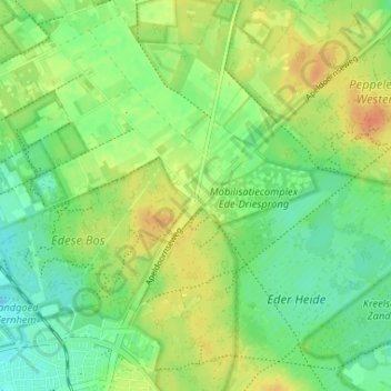
Name: Driesprong topographic map, elevation, terrain.
Location: Driesprong, Ede, Gelderland, Nederland, 6718 TP, Nederland (52.04667 5.66936 52.08667 5.70936)
Average elevation: 105 ft
Minimum elevation: 52 ft
Maximum elevation: 167 ft
Other topographic maps
Click on a map to view its topography, its elevation and its terrain.
Edese Bos - Oost
Nederland > Gelderland > Ede
Edese Bos - Oost, Ede, Gelderland, Nederland, 6718 ZZ, Nederland
Average elevation: 112 ft
Vlinderdas (Noord Ginkel)
Nederland > Gelderland > Ede
Vlinderdas (Noord Ginkel), Ede, Gelderland, Nederland, 6718SL, Nederland
Average elevation: 89 ft
Noord Ginkel
Nederland > Gelderland > Ede
Noord Ginkel, Groot Ginkelseweg, Ede, Gelderland, Nederland, 6718 SL, Nederland
Average elevation: 95 ft