
Pandurangapuram topographic map
Interactive map
Click on the map to display elevation.
About this map
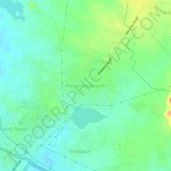
Name: Pandurangapuram topographic map, elevation, terrain.
Average elevation: 449 ft
Minimum elevation: 400 ft
Maximum elevation: 548 ft
Other topographic maps
Click on a map to view its topography, its elevation and its terrain.
Khammam
India > Telangana > Khammam_Urban mandal
Khammam, Khammam_Urban mandal, Khammam District, Telangana, 507002, India
Average elevation: 427 ft