
Westendorf topographic map
Interactive map
Click on the map to display elevation.
About this map
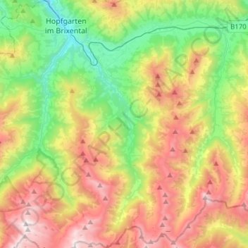
Name: Westendorf topographic map, elevation, terrain.
Location: Westendorf, Bezirk Kitzbühel, 6363, Österreich (47.29846 12.16056 47.46775 12.27037)
Average elevation: 4,377 ft
Minimum elevation: 1,886 ft
Maximum elevation: 7,969 ft
Die komplette Liste der Statistik Austria ist in: Topographische Siedlungskennzeichnung nach STAT