
Kolomyia topographic map
Interactive map
Click on the map to display elevation.
About this map
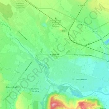
Name: Kolomyia topographic map, elevation, terrain.
Location: Kolomyia, Ivano-Frankivsk Oblast, 78200, Ukraine (48.48592 24.99805 48.56592 25.07805)
Average elevation: 951 ft
Minimum elevation: 840 ft
Maximum elevation: 1,224 ft