
Kuehn Conservation Area topographic map
Interactive map
Click on the map to display elevation.
About this map
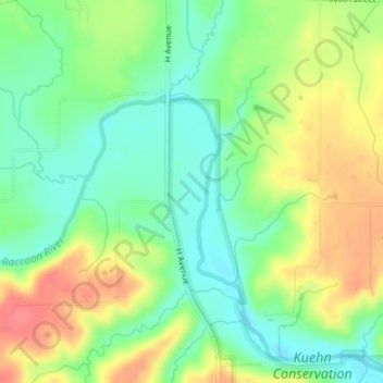
Name: Kuehn Conservation Area topographic map, elevation, terrain.
Location: Kuehn Conservation Area, Kennedy, Dallas County, Iowa, USA (41.58327 -94.14890 41.58337 -94.14880)
Average elevation: 965 ft
Minimum elevation: 876 ft
Maximum elevation: 1,079 ft