
Mohali topographic map
Interactive map
Click on the map to display elevation.
About this map
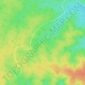
Name: Mohali topographic map, elevation, terrain.
Location: Mohali, Rehli Tahsil, Sagar District, Madhya Pradesh, India (23.51491 79.22031 23.54831 79.24315)
Average elevation: 1,411 ft
Minimum elevation: 1,342 ft
Maximum elevation: 1,476 ft