Geolocate

Godini topographic map

Click on the map to display elevation.

About this map

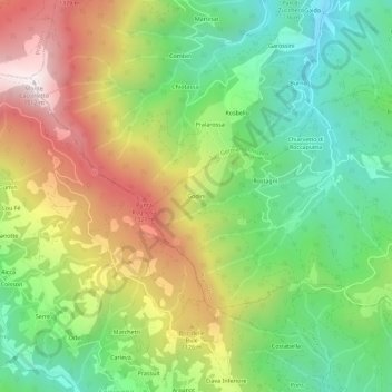
Name: Godini topographic map, elevation, terrain.

Location: Godini, Prarostino, Torino, Piedmont, 10065, Italy (44.84354 7.21523 44.88354 7.25523)

Average elevation: 3,005 ft

Minimum elevation: 1,634 ft

Maximum elevation: 4,957 ft

Gear up for your next adventure:

🪶Survival Guide Book - Expert advice for emergency preparedness
🌄Hiking Binoculars - Compact binoculars for scenic views and trail spotting
🦺Reflective Outdoor Gear - Safety gear for low‑light conditions
🗺️Topographic Maps - Detailed topo maps for hiking, exploring and outdoor navigation
🔥Plasma Lighters - Windproof lighters that work in any weather condition

As an Amazon Associate, this site earns from qualifying purchases at no extra cost to you.