
Río La Silla topographic map
Interactive map
Click on the map to display elevation.
About this map
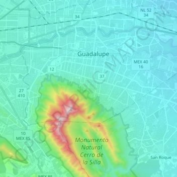
Name: Río La Silla topographic map, elevation, terrain.
Location: Río La Silla, Guadalupe, Juárez, Nuevo León, México (25.61532 -100.27430 25.68292 -100.12804)
Average elevation: 1,942 ft
Minimum elevation: 1,339 ft
Maximum elevation: 5,771 ft