Geolocate

Maron topographic map

Click on the map to display elevation.

About this map
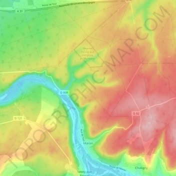
Name: Maron topographic map, elevation, terrain.

Location: Maron, Nancy, Meurthe-et-Moselle, Grand Est, Metropolitan France, 54230, France (48.62227 6.01708 48.69268 6.08571)

Average elevation: 1,043 ft

Minimum elevation: 689 ft

Maximum elevation: 1,375 ft

Other topographic maps

Click on a map to view its topography, its elevation and its terrain.

Gear up for your next adventure:

🪶Wildlife Field Guides - Learn animal tracking and species ID
🪶Camp Gear Gift Set - Perfect gift bundle for outdoor fans
💧Water Filtration Bottles - Safely drink from streams and lakes while exploring
📶Satellite Messenger - Communication device off‑grid
🛰️Satellite Messengers - Emergency SOS and two-way messaging for off-grid adventures

As an Amazon Associate, this site earns from qualifying purchases at no extra cost to you.