
安里西村 topographic map
Interactive map
Click on the map to display elevation.
About this map
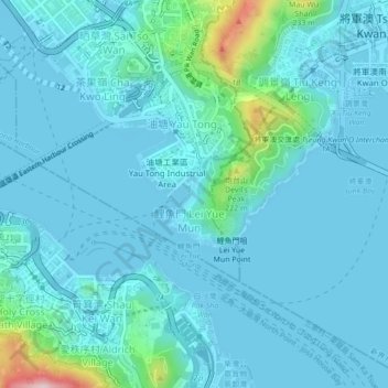
Name: 安里西村 topographic map, elevation, terrain.
Location: 安里西村, 觀塘區, 九龍, 香港, 中国 (22.27132 114.21925 22.31132 114.25925)
Average elevation: 128 ft
Minimum elevation: -7 ft
Maximum elevation: 1,115 ft
Other topographic maps
Click on a map to view its topography, its elevation and its terrain.