
Casais de Britos topographic map
Interactive map
Click on the map to display elevation.
About this map
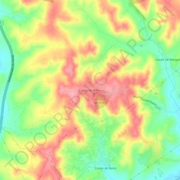
Name: Casais de Britos topographic map, elevation, terrain.
Location: Casais de Britos, Azambuja, Lisboa, 2050-360, Portugal (39.06217 -8.92755 39.10217 -8.88755)
Average elevation: 197 ft
Minimum elevation: 16 ft
Maximum elevation: 367 ft
Other topographic maps
Click on a map to view its topography, its elevation and its terrain.
Manique do Intendente
Manique do Intendente, Azambuja, Lisboa, 2065-311, Portugal
Average elevation: 230 ft
Casais da Lagoa
Casais da Lagoa, Aveiras de Baixo, Azambuja, Lisboa, 2070-214, Portugal
Average elevation: 174 ft
Casais de Baixo
Casais de Baixo, Azambuja, Lisboa, 2050-360, Portugal
Average elevation: 138 ft