
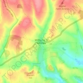
Milborne St Andrew topographic map
Interactive map
Click on the map to display elevation.
About this map
Name: Milborne St Andrew topographic map, elevation, terrain.
Location: Milborne St Andrew, Dorset, England, DT11 0JF, United Kingdom (50.75816 -2.30166 50.79816 -2.26166)
Average elevation: 315 ft
Minimum elevation: 167 ft
Maximum elevation: 453 ft