
Moratalla topographic map
Interactive map
Click on the map to display elevation.
About this map
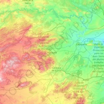
Name: Moratalla topographic map, elevation, terrain.
Location: Moratalla, Noroeste, Murcia, Spanje (38.00105 -2.34441 38.38129 -1.66932)
Average elevation: 2,503 ft
Minimum elevation: 728 ft
Maximum elevation: 6,020 ft
Other topographic maps
Click on a map to view its topography, its elevation and its terrain.