
Sacuchum Dolores topographic map
Interactive map
Click on the map to display elevation.
About this map
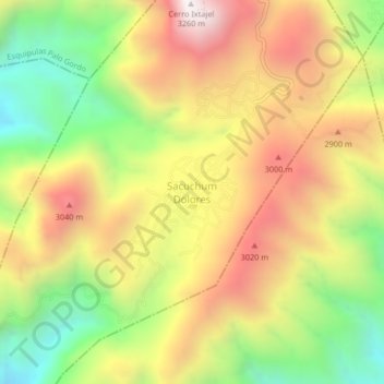
Name: Sacuchum Dolores topographic map, elevation, terrain.
Location: Sacuchum Dolores, Nuevo Progreso, San Marcos, Guatemala (14.86466 -91.83435 14.90466 -91.79435)
Average elevation: 8,750 ft
Minimum elevation: 6,795 ft
Maximum elevation: 10,699 ft