
Δήμος Κεντρικής Κέρκυρας και Διαποντίων Νήσων topographic map
Interactive map
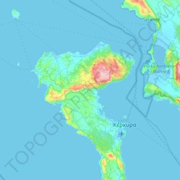
Click on the map to display elevation.
About this map
Name: Δήμος Κεντρικής Κέρκυρας και Διαποντίων Νήσων topographic map, elevation, terrain.
Average elevation: 135 ft
Minimum elevation: -23 ft
Maximum elevation: 2,861 ft
Other topographic maps
Click on a map to view its topography, its elevation and its terrain.
Korfu
Griechenland > Peloponnes, Westgriechenland und Ionische Inseln > Regionalbezirk Korfu
Korfu, Regionalbezirk Korfu, Region der Ionischen Inseln, Peloponnes, Westgriechenland und Ionische Inseln, Griechenland
Average elevation: 135 ft