
Midori Ward topographic map
Interactive map
Click on the map to display elevation.
About this map
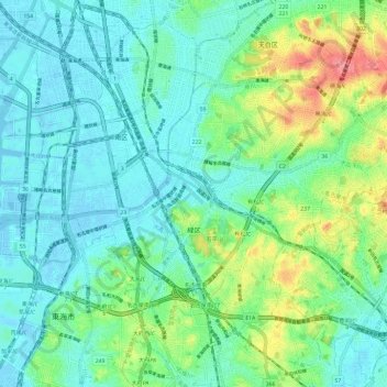
Name: Midori Ward topographic map, elevation, terrain.
Location: Midori Ward, Nagoya, Aichi Prefecture, Chubu Region, Japan (35.03920 136.90579 35.10972 137.02362)
Average elevation: 66 ft
Minimum elevation: -16 ft
Maximum elevation: 259 ft
Other topographic maps
Click on a map to view its topography, its elevation and its terrain.