
Cao Lộc District topographic map
Interactive map
Click on the map to display elevation.
About this map
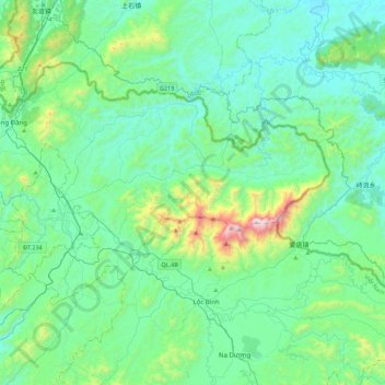
Name: Cao Lộc District topographic map, elevation, terrain.
Location: Cao Lộc District, Lạng Sơn Province, Vietnam (21.73674 106.62370 22.01314 107.06374)
Average elevation: 1,135 ft
Minimum elevation: 367 ft
Maximum elevation: 4,862 ft
Other topographic maps
Click on a map to view its topography, its elevation and its terrain.
Phặt Chỉ
Vietnam > Lạng Sơn Province > Lộc Bình District > Mẫu Sơn Commune
Phặt Chỉ, Mẫu Sơn Commune, Lộc Bình District, Lạng Sơn Province, Vietnam
Average elevation: 2,533 ft