
Uji topographic map
Interactive map
Click on the map to display elevation.
About this map
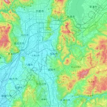
Name: Uji topographic map, elevation, terrain.
Location: Uji, Kyoto Prefecture, 611-0021, Japan (34.73337 135.64592 35.05337 135.96592)
Average elevation: 525 ft
Minimum elevation: -10 ft
Maximum elevation: 2,572 ft
Other topographic maps
Click on a map to view its topography, its elevation and its terrain.