
Andreasberg topographic map
Interactive map
Click on the map to display elevation.
About this map
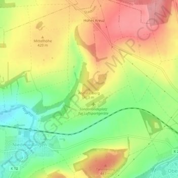
Name: Andreasberg topographic map, elevation, terrain.
Average elevation: 1,316 ft
Minimum elevation: 1,138 ft
Maximum elevation: 1,483 ft
Other topographic maps
Click on a map to view its topography, its elevation and its terrain.
Dörnfeld an der Ilm
Deutschland > Thüringen > Ilm-Kreis > Stadtilm
Dörnfeld an der Ilm, Stadtilm, Ilm-Kreis, Thüringen, 99326, Deutschland
Average elevation: 1,391 ft
Hammersfeld
Deutschland > Thüringen > Ilm-Kreis > Stadtilm > Hammersfeld
Hammersfeld, Stadtilm, Ilm-Kreis, Thüringen, 99326, Deutschland
Average elevation: 1,365 ft