
Entrevinhas topographic map
Interactive map
Click on the map to display elevation.
About this map
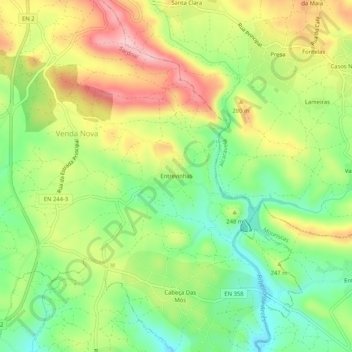
Name: Entrevinhas topographic map, elevation, terrain.
Location: Entrevinhas, Sardoal, Santarém, 2230-008, Portugal (39.52322 -8.14688 39.56322 -8.10688)
Average elevation: 732 ft
Minimum elevation: 459 ft
Maximum elevation: 1,066 ft
Other topographic maps
Click on a map to view its topography, its elevation and its terrain.
Alcaravela
Alcaravela, Sardoal, Santarém, 2230-008, Portugal
Average elevation: 915 ft
Monte Cimeiro
Portugal > Santarém > Sardoal > Alcaravela
Monte Cimeiro, Alcaravela, Sardoal, Santarém, 2230-008, Portugal
Average elevation: 1,010 ft
São Domingos
São Domingos, Santiago de Montalegre, Sardoal, Santarém, 2230-052, Portugal
Average elevation: 886 ft