
Castiglioncello topographic map
Interactive map
Click on the map to display elevation.
About this map
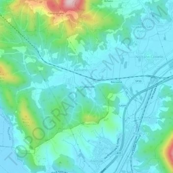
Name: Castiglioncello topographic map, elevation, terrain.
Location: Castiglioncello, Balbano, Lucca, Toscana, 55050, Italia (43.80810 10.37764 43.84810 10.41764)
Average elevation: 236 ft
Minimum elevation: -16 ft
Maximum elevation: 1,247 ft