
Melle topographic map
Click on the map to display elevation.
About this map
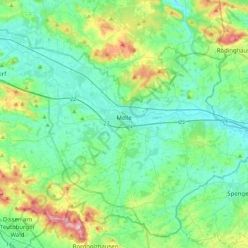
Name: Melle topographic map, elevation, terrain.
Location: Melle, Landkreis Osnabrück, Lower Saxony, Germany (52.10795 8.20305 52.28313 8.51731)
Average elevation: 384 ft
Minimum elevation: 210 ft
Maximum elevation: 988 ft
Other topographic maps
Click on a map to view its topography, its elevation and its terrain.
Ahausen
Germany > Lower Saxony > Landkreis Osnabrück > Bersenbrück > Ahausen
Average elevation: 148 ft