

Dessau topographic map
Click on the map to display elevation.
Dessau
Dessau is situated on a floodplain where the Mulde flows into the Elbe. This causes yearly floods. The worst flood took place in the year 2002, when the Waldersee district was nearly completely flooded. The south of Dessau touches a well-wooded area called Mosigkauer Heide. The highest elevation is a 110 m high former rubbish dump called Scherbelberg in the southwest of Dessau. Dessau is surrounded by numerous parks and palaces that make it one of the greenest towns in Germany.
About this map
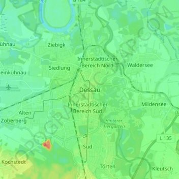
Name: Dessau topographic map, elevation, terrain.
Location: Dessau, Dessau-Roßlau, Saxony-Anhalt, 06844, Germany (51.79100 12.20307 51.87100 12.28307)
Average elevation: 203 ft
Minimum elevation: 161 ft
Maximum elevation: 325 ft