
Jowzjan topographic map
Interactive map
Click on the map to display elevation.
About this map
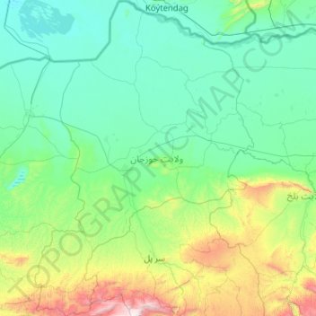
Name: Jowzjan topographic map, elevation, terrain.
Location: Jowzjan, Afghanistan (35.90737 65.16049 37.55085 66.57564)
Average elevation: 1,847 ft
Minimum elevation: 771 ft
Maximum elevation: 9,918 ft
Other topographic maps
Click on a map to view its topography, its elevation and its terrain.