
Thank you for supporting this site ❤️
Make a donation
Make a donation
Gear up for your next adventure:
As an Amazon Associate, this site earns from qualifying purchases at no extra cost to you.
Gurmul topographic map
Click on the map to display elevation.
Thank you for supporting this site ❤️
Make a donation
Make a donation
Gear up for your next adventure:
As an Amazon Associate, this site earns from qualifying purchases at no extra cost to you.
About this map
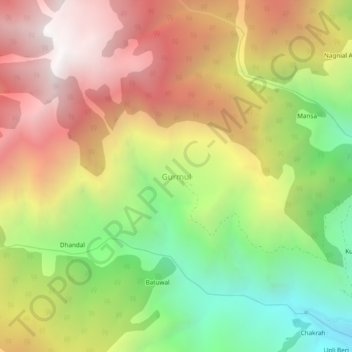
Name: Gurmul topographic map, elevation, terrain.
Location: Gurmul, Doda, Jammu and Kashmir, 182145, India (33.18500 75.41161 33.22500 75.45161)
Average elevation: 7,585 ft
Minimum elevation: 4,341 ft
Maximum elevation: 10,755 ft
Thank you for supporting this site ❤️
Make a donation
Make a donation
Gear up for your next adventure:
As an Amazon Associate, this site earns from qualifying purchases at no extra cost to you.