
Cerro de Montevideo topographic map
Interactive map
Click on the map to display elevation.
About this map
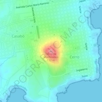
Name: Cerro de Montevideo topographic map, elevation, terrain.
Location: Cerro de Montevideo, Montevideo, 12800, Uruguay (-34.88831 -56.26029 -34.88821 -56.26019)
Average elevation: 89 ft
Minimum elevation: -3 ft
Maximum elevation: 430 ft
Other topographic maps
Click on a map to view its topography, its elevation and its terrain.
Ciudad Vieja
Uruguay > Montevideo > Montevideo
Ciudad Vieja, Montevideo, 11000, Uruguay
Average elevation: 23 ft