
San Antonio topographic map
Interactive map
Click on the map to display elevation.
About this map
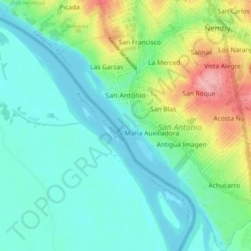
Name: San Antonio topographic map, elevation, terrain.
Average elevation: 259 ft
Minimum elevation: 157 ft
Maximum elevation: 538 ft
Other topographic maps
Click on a map to view its topography, its elevation and its terrain.
Bezirk Ita
Paraguay > Zentral-Departement
Bezirk Ita, Zentral-Departement, Región Oriental, 110510, Paraguay
Average elevation: 387 ft