
Wold topographic map
Interactive map
Click on the map to display elevation.
About this map
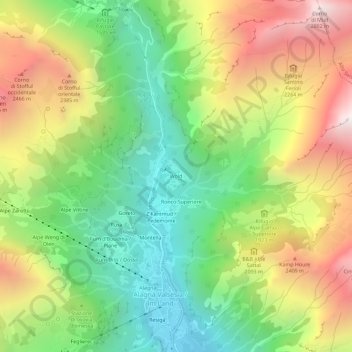
Name: Wold topographic map, elevation, terrain.
Location: Wold, Alagna Valsesia, Vercelli, Piedmont, 13021, Italy (45.84516 7.91975 45.88516 7.95975)
Average elevation: 6,079 ft
Minimum elevation: 3,704 ft
Maximum elevation: 9,324 ft