
Svanvik topographic map
Interactive map
Click on the map to display elevation.
About this map
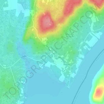
Name: Svanvik topographic map, elevation, terrain.
Location: Svanvik, Finnmark, Norway (69.43856 30.01381 69.47856 30.05381)
Average elevation: 121 ft
Minimum elevation: 59 ft
Maximum elevation: 361 ft