
Rippon topographic map
Interactive map
Click on the map to display elevation.
About this map
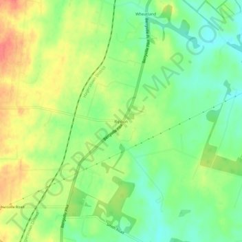
Name: Rippon topographic map, elevation, terrain.
Location: Rippon, Jefferson County, West Virginia, 25441, USA (39.19844 -77.92527 39.23844 -77.88527)
Average elevation: 512 ft
Minimum elevation: 430 ft
Maximum elevation: 610 ft