
Korsør topographic map
Interactive map
Click on the map to display elevation.
About this map
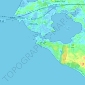
Name: Korsør topographic map, elevation, terrain.
Location: Korsør, Slagelse Municipality, Region Zealand, 4220, Denmark (55.28660 11.10259 55.36660 11.18259)
Average elevation: 7 ft
Minimum elevation: -46 ft
Maximum elevation: 89 ft