
Château de Soiron topographic map
Interactive map
Click on the map to display elevation.
About this map
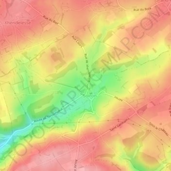
Name: Château de Soiron topographic map, elevation, terrain.
Average elevation: 804 ft
Minimum elevation: 554 ft
Maximum elevation: 938 ft
Other topographic maps
Click on a map to view its topography, its elevation and its terrain.
Château de Sclassin
Belgium > Wallonia > Pepinster > Tribomont
Château de Sclassin, 1, Sclassin, Tribomont, Pepinster, Liège, Wallonia, 4860, Belgium
Average elevation: 794 ft