
Coats topographic map
Interactive map
Click on the map to display elevation.
About this map
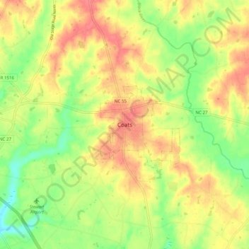
Name: Coats topographic map, elevation, terrain.
Location: Coats, Harnett County, Caroline du Nord, 27521, États-Unis (35.36794 -78.71196 35.44794 -78.63196)
Average elevation: 240 ft
Minimum elevation: 125 ft
Maximum elevation: 335 ft