
Santorcaz topographic map
Interactive map
Click on the map to display elevation.
About this map
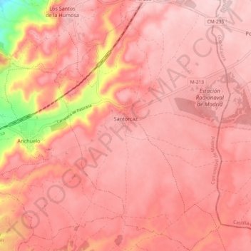
Name: Santorcaz topographic map, elevation, terrain.
Location: Santorcaz, Cuenca del Henares, Community of Madrid, Spain (40.43474 -3.25965 40.50447 -3.19536)
Average elevation: 2,805 ft
Minimum elevation: 2,215 ft
Maximum elevation: 2,963 ft