
Innsbruck topographic map
Interactive map
Click on the map to display elevation.
About this map
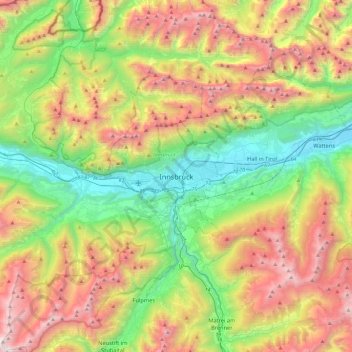
Name: Innsbruck topographic map, elevation, terrain.
Location: Innsbruck, Tyrol, 6020, Austria (47.10543 11.23277 47.42543 11.55277)
Average elevation: 4,970 ft
Minimum elevation: 1,785 ft
Maximum elevation: 9,800 ft
Other topographic maps
Click on a map to view its topography, its elevation and its terrain.