
Tansa River topographic map
Interactive map
Click on the map to display elevation.
About this map
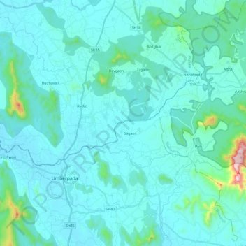
Name: Tansa River topographic map, elevation, terrain.
Average elevation: 276 ft
Minimum elevation: 30 ft
Maximum elevation: 2,743 ft
Other topographic maps
Click on a map to view its topography, its elevation and its terrain.
Ulhas River
India > Maharashtra > Kalyan-Dombivli
Ulhas River, Kalyan-Dombivli, Thane, Maharashtra, 421301, India
Average elevation: 56 ft
Bhatsa
India > Maharashtra > Kalyan-Dombivli
Bhatsa, Kalyan-Dombivli, Thane, Maharashtra, 421301, India
Average elevation: 105 ft