
Puylaurent topographic map
Interactive map
Click on the map to display elevation.
About this map
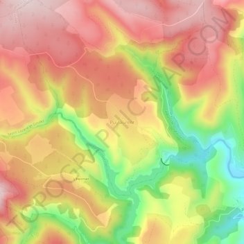
Name: Puylaurent topographic map, elevation, terrain.
Average elevation: 3,461 ft
Minimum elevation: 2,789 ft
Maximum elevation: 3,924 ft
Other topographic maps
Click on a map to view its topography, its elevation and its terrain.
Les Huttes
France > Occitanie > Lozère > La Bastide-Puylaurent > La Bastide
Les Huttes, La Bastide, La Bastide-Puylaurent, Mende, Lozère, Occitanie, France métropolitaine, 48250, France
Average elevation: 3,570 ft
La Bastide
France > Occitanie > Lozère > La Bastide-Puylaurent
La Bastide, La Bastide-Puylaurent, Mende, Lozère, Occitanie, France métropolitaine, 48250, France
Average elevation: 3,556 ft
Masméjean
France > Occitanie > Lozère > La Bastide-Puylaurent
Masméjean, La Bastide-Puylaurent, Mende, Lozère, Occitanie, France métropolitaine, 48250, France
Average elevation: 3,750 ft