
Swansea Marina topographic map
Interactive map
Click on the map to display elevation.
About this map
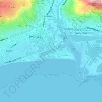
Name: Swansea Marina topographic map, elevation, terrain.
Average elevation: 72 ft
Minimum elevation: -10 ft
Maximum elevation: 627 ft
Other topographic maps
Click on a map to view its topography, its elevation and its terrain.
Museum Green
Royaume-Uni > Pays de Galles > Swansea
Museum Green, Mount Pleasant, Castle, Swansea, Pays de Galles, Royaume-Uni
Average elevation: 92 ft
Bridgend
Royaume-Uni > Pays de Galles > Swansea > Bridgend
Bridgend, Swansea, Mid Glamorgan, Pays de Galles, CF31 1BZ, Royaume-Uni
Average elevation: 187 ft