
Bout du Col topographic map
Interactive map
Click on the map to display elevation.
About this map
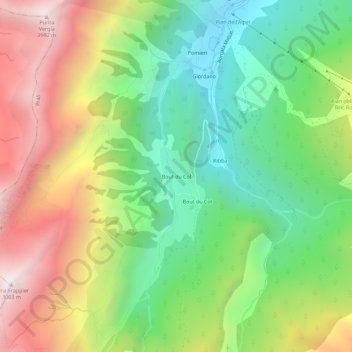
Name: Bout du Col topographic map, elevation, terrain.
Location: Bout du Col, Prali, Turin, Piémont, Italie (44.84458 7.01413 44.88458 7.05413)
Average elevation: 6,900 ft
Minimum elevation: 4,810 ft
Maximum elevation: 9,816 ft