
Martinskapelle topographic map
Interactive map
Click on the map to display elevation.
About this map
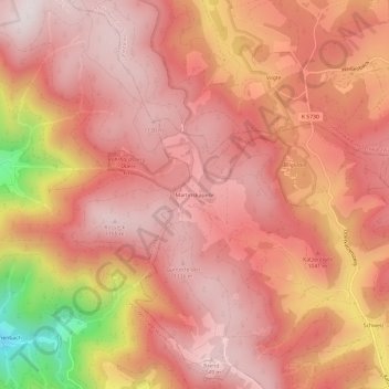
Name: Martinskapelle topographic map, elevation, terrain.
Average elevation: 3,281 ft
Minimum elevation: 1,752 ft
Maximum elevation: 3,839 ft
Other topographic maps
Click on a map to view its topography, its elevation and its terrain.
Staatsberg
Duitsland > Baden-Württemberg > Schwarzwald-Baar-Kreis > Furtwangen im Schwarzwald
Staatsberg, Furtwangen im Schwarzwald, Verwaltungsgemeinschaft Furtwangen im Schwarzwald, Schwarzwald-Baar-Kreis, Baden-Württemberg, 78120, Duitsland
Average elevation: 3,241 ft