
Winschoterdiep topographic map
Interactive map
Click on the map to display elevation.
About this map
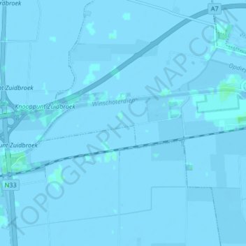
Name: Winschoterdiep topographic map, elevation, terrain.
Location: Winschoterdiep, Oldambt, Groningen, Nederland, 9636AL, Nederland (53.16397 6.89261 53.17485 6.95970)
Average elevation: 0 ft
Minimum elevation: -10 ft
Maximum elevation: 13 ft
Other topographic maps
Click on a map to view its topography, its elevation and its terrain.
Nieuw Beerta
Nederland > Groningen > Oldambt
Nieuw Beerta, Oldambt, Groningen, Nederland
Average elevation: -7 ft
Nieuw Scheemda
Nederland > Groningen > Oldambt
Nieuw Scheemda, Oldambt, Groningen, Nederland
Average elevation: -3 ft