
Black Range State Park topographic map
Interactive map
Click on the map to display elevation.
About this map
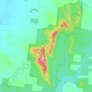
Name: Black Range State Park topographic map, elevation, terrain.
Average elevation: 764 ft
Minimum elevation: 538 ft
Maximum elevation: 1,785 ft
Other topographic maps
Click on a map to view its topography, its elevation and its terrain.
Mount Arapiles
Australia > Victoria > Horsham
Mount Arapiles, Rural City of Horsham, Victoria, Australia
Average elevation: 719 ft
St Helens Plains
Australia > Victoria > Horsham
St Helens Plains, Horsham, Rural City of Horsham, Grampians, Victoria, Australia
Average elevation: 495 ft