
Cerro Gordo topographic map
Interactive map
Click on the map to display elevation.
About this map
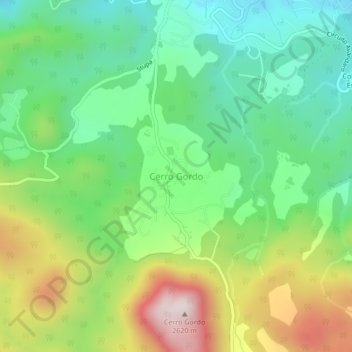
Name: Cerro Gordo topographic map, elevation, terrain.
Location: Cerro Gordo, Valle de Bravo, 51239, México (19.11664 -100.16636 19.15664 -100.12636)
Average elevation: 7,129 ft
Minimum elevation: 6,329 ft
Maximum elevation: 8,560 ft
Other topographic maps
Click on a map to view its topography, its elevation and its terrain.
Rincón de Estradas
Rincón de Estradas, Valle de Bravo, 51207, México
Average elevation: 6,854 ft