
Khao Rup Chang topographic map
Interactive map
Click on the map to display elevation.
About this map
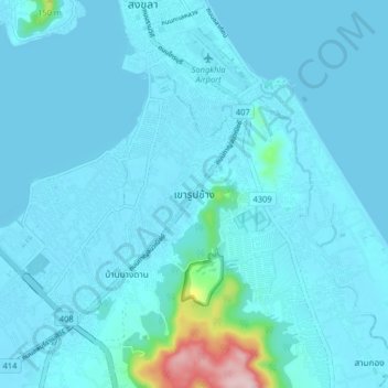
Name: Khao Rup Chang topographic map, elevation, terrain.
Location: Khao Rup Chang, Phawong, Songkhla Province, 90000, Thailand (7.11825 100.56391 7.19825 100.64391)
Average elevation: 69 ft
Minimum elevation: -7 ft
Maximum elevation: 922 ft
Other topographic maps
Click on a map to view its topography, its elevation and its terrain.
Ban La Nga
Ban La Nga, Ban Na, Songkhla Province, Thailand
Average elevation: 33 ft
Hat Yai
Hat Yai, Kho Hong, Songkhla Province, Thailand
Average elevation: 154 ft