
Les Bochones topographic map
Interactive map
Click on the map to display elevation.
About this map
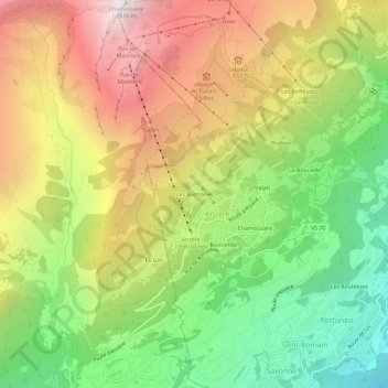
Name: Les Bochones topographic map, elevation, terrain.
Location: Les Bochones, Anzère, Ayent, Hérens, Wallis, 1972, Switzerland (46.27904 7.37553 46.31904 7.41553)
Average elevation: 5,210 ft
Minimum elevation: 2,359 ft
Maximum elevation: 8,481 ft
Other topographic maps
Click on a map to view its topography, its elevation and its terrain.