
Domblans topographic map
Interactive map
Click on the map to display elevation.
About this map
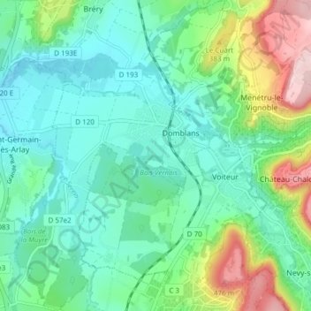
Name: Domblans topographic map, elevation, terrain.
Average elevation: 974 ft
Minimum elevation: 741 ft
Maximum elevation: 1,634 ft
Other topographic maps
Click on a map to view its topography, its elevation and its terrain.
Château de la Muyre
France > Bourgogne-Franche-Comté > Jura > Domblans > La Muyre
Château de la Muyre, Rue du Château, La Muyre, Domblans, Lons-le-Saunier, Jura, Bourgogne-Franche-Comté, France métropolitaine, 39210, France
Average elevation: 843 ft
Bréry
France > Bourgogne-Franche-Comté > Jura > Domblans
Bréry, Domblans, Lons-le-Saunier, Jura, Bourgogne-Franche-Comté, France métropolitaine, 39230, France
Average elevation: 938 ft