
Clarendon Township topographic map
Interactive map
Click on the map to display elevation.
About this map
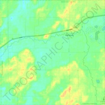
Name: Clarendon Township topographic map, elevation, terrain.
Location: Clarendon Township, Calhoun County, Michigan, United States (42.07243 -84.94276 42.15948 -84.82639)
Average elevation: 984 ft
Minimum elevation: 945 ft
Maximum elevation: 1,033 ft
Other topographic maps
Click on a map to view its topography, its elevation and its terrain.
Sheridan Township
United States > Michigan > Calhoun County
Sheridan Township, Calhoun County, Michigan, United States
Average elevation: 968 ft
Battle Creek
United States > Michigan > Calhoun County
Battle Creek, Calhoun County, Michigan, 49015, United States
Average elevation: 899 ft
Burlington Township
United States > Michigan > Calhoun County
Burlington Township, Calhoun County, Michigan, 49029, United States
Average elevation: 928 ft
Athens Township
United States > Michigan > Calhoun County
Athens Township, Calhoun County, Michigan, 49011, United States
Average elevation: 899 ft