
二地 topographic map
Interactive map
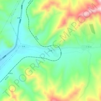
Click on the map to display elevation.
About this map
Name: 二地 topographic map, elevation, terrain.
Average elevation: 4,252 ft
Minimum elevation: 3,763 ft
Maximum elevation: 5,154 ft
Other topographic maps
Click on a map to view its topography, its elevation and its terrain.
二地
Chine > Mongolie-Intérieure > Bannière de Hexigten > 经棚镇
二地, 经棚镇, Bannière de Hexigten, 赤峰市, Mongolie-Intérieure, Chine
Average elevation: 3,783 ft