
Lunteren topographic map
Interactive map
Click on the map to display elevation.
About this map
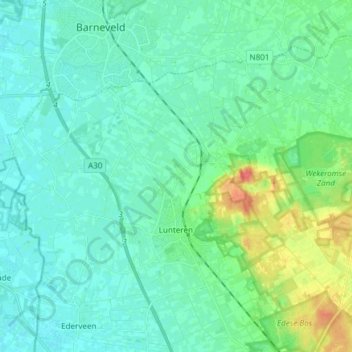
Name: Lunteren topographic map, elevation, terrain.
Location: Lunteren, Ede, Geldern, Niederlande (52.06639 5.54674 52.13469 5.69692)
Average elevation: 49 ft
Minimum elevation: 20 ft
Maximum elevation: 171 ft
Other topographic maps
Click on a map to view its topography, its elevation and its terrain.