
Biosphärengebiet Schwäbische Alb (Kernzone) topographic map
Interactive map
Click on the map to display elevation.
About this map
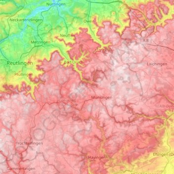
Name: Biosphärengebiet Schwäbische Alb (Kernzone) topographic map, elevation, terrain.
Average elevation: 2,129 ft
Minimum elevation: 899 ft
Maximum elevation: 2,887 ft
Other topographic maps
Click on a map to view its topography, its elevation and its terrain.
Offenhausen
Deutschland > Baden-Württemberg > Landkreis Reutlingen > Gomadingen
Offenhausen, Gomadingen, Gemeindeverwaltungsverband Münsingen, Landkreis Reutlingen, Baden-Württemberg, 72532, Deutschland
Average elevation: 2,375 ft